
Little Greyback Trail to Squaw Peak

The Little Greyback Trail to Squaw Peak is 11 miles out-and-back and completely worth the effort.
Driving
– It is a 70 minute drive from Ashland Plaza and that last 10 minutes is on a bumpy gravel road.
Head north on the 5… just get there. Then get off on the Phoenix exit (before Medford) and turn left. Then, turn right on Highway 99 for less than a mile and turn left on South Stage Road towards Jacksonville. There’s a quick jog right and then left on Griffin Creek Road and then South Stage turns into California Road as you drive through Jacksonville.
As you emerge from Jacksonville you are on Route 238 heading to Applegate. It’s rural. It’s nice. Keep an eye out for Upper Applegate Road in about 10 minutes. You’ll turn left at a city called Ruch, but you aren’t going to see a city, you’ll just see a yellow church/school building. So turn left and you have 20 minutes on Upper Applegate Road driving along the Applegate River. Some roads split off, but head toward Applegate Lake and Applegate Dam.
Turn left onto the road on top of the dam. French Gulch Road. Stay on this paved road and when it makes a hairpin turn to your right continue forward onto the gravel road – still officially French Gulch I believe – and it will feel like you are one someone’s driveway. There are about a dozen driveways that split off of this road, and some are so much nicer that the road so you can easily get confused, but pay attention and drive slowly and within 10 bumpy minutes you will arrive at the trailhead.
Parking
– You will arrive at a Forest Service road intersection with a… I’d call it a “widening” for parking. It’s not great signage and the 6ish parking spots are really makeshift, but that’s remote trailhead access for ya.
The Adventure
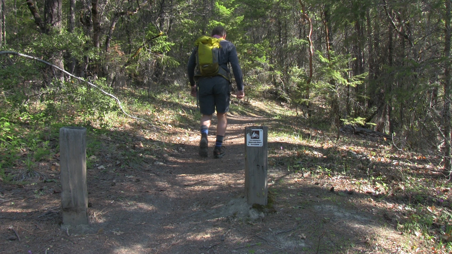
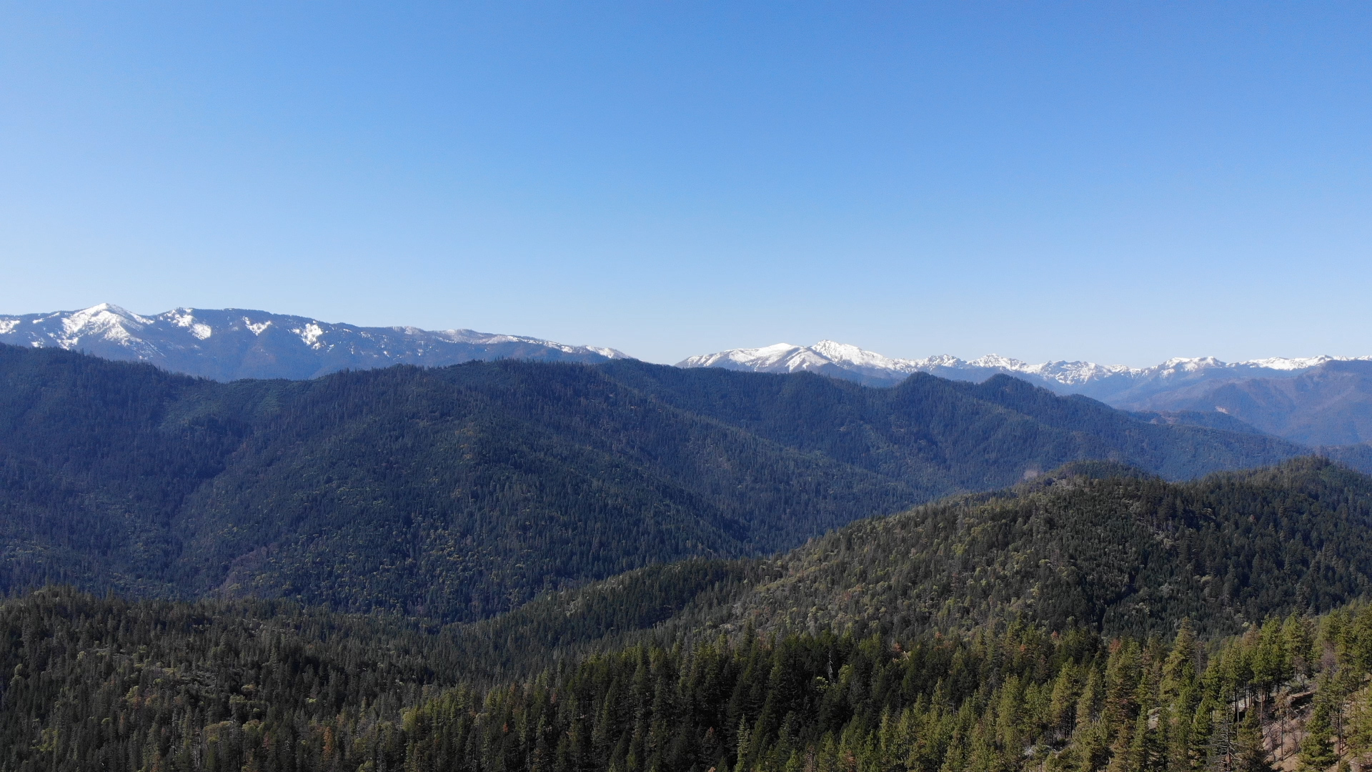
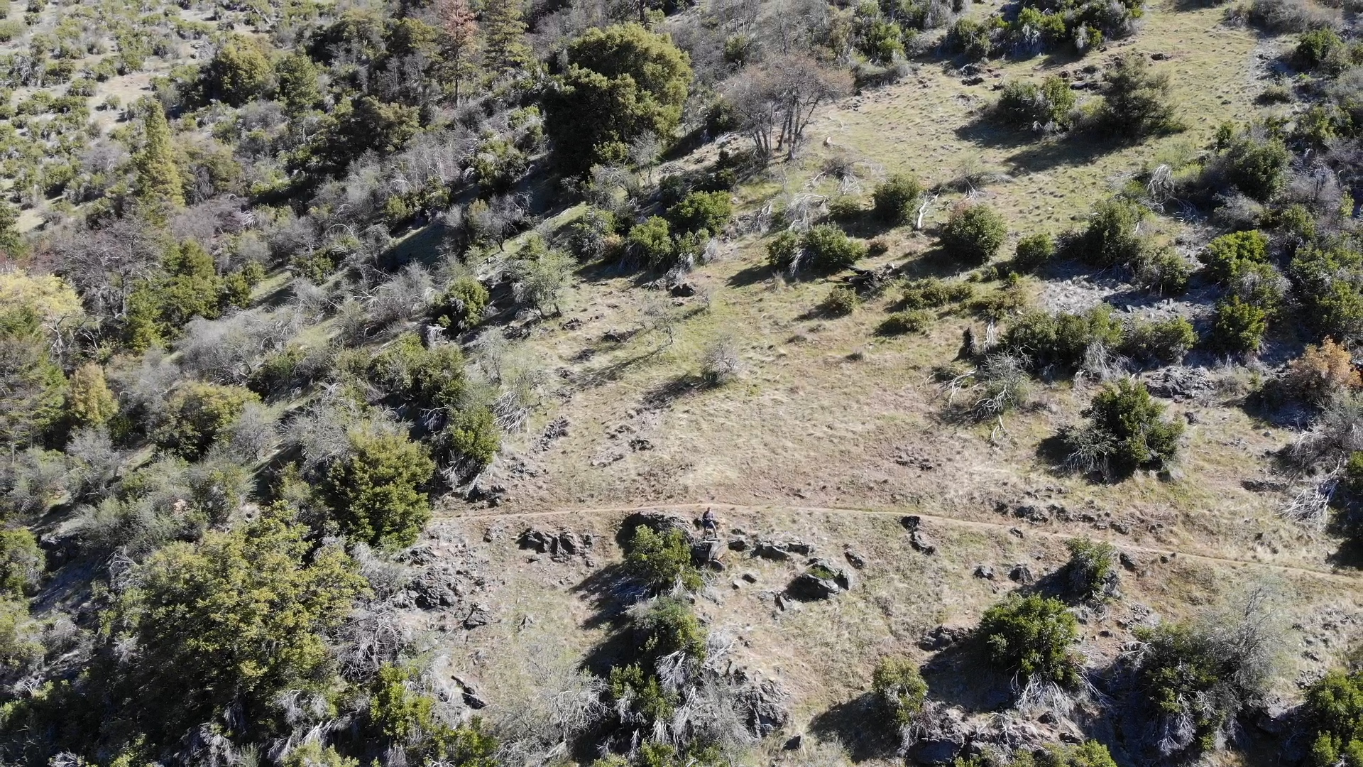
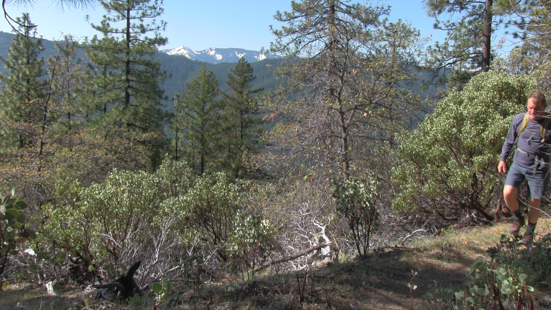
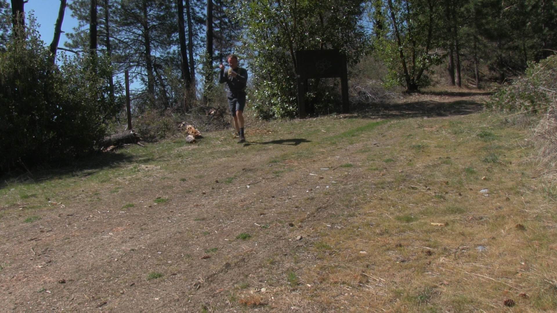
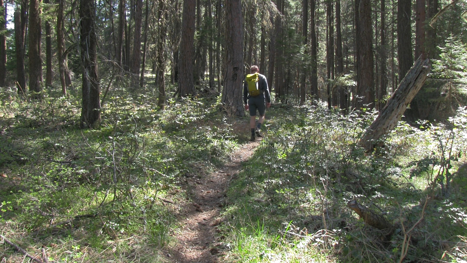
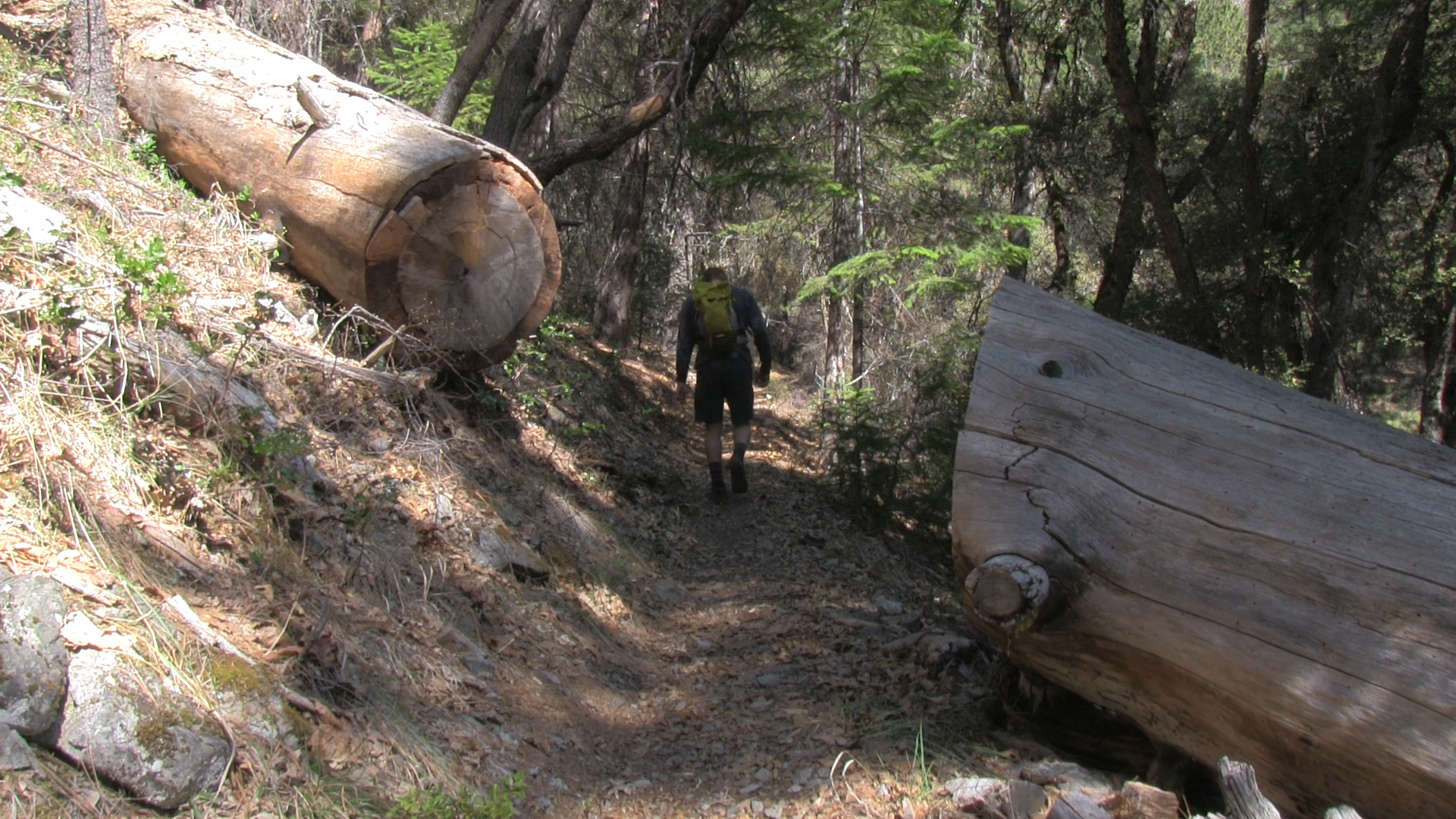
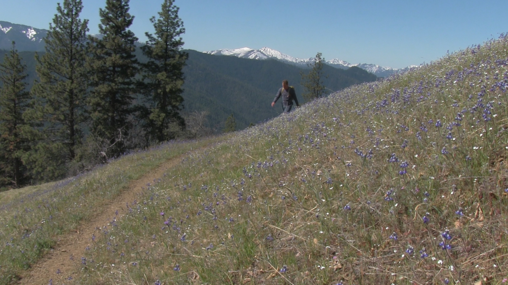
– To the left you will see – 20 feet in – some official trailhead posts and signs. Despite the questionable last 10 minutes of dirt road driving, and the unmaintained parking area, the trail starts off perfectly! Well maintained single track gently rising along the side of a mountain. The next 4 miles are wonderful. Mostly shaded with a number of dramatic openings with fields and views of the Red Butte Mountains. I think it’s the fact that you can’t see the top of the mountain, or the bottom of the mountain, and the slope of the hillside is decent but not scary, that makes this trail so… satisfying. It does get a little brushy for a bit at about mile 3 and I think that is where I picked up a tick but… completely worth getting a tick!
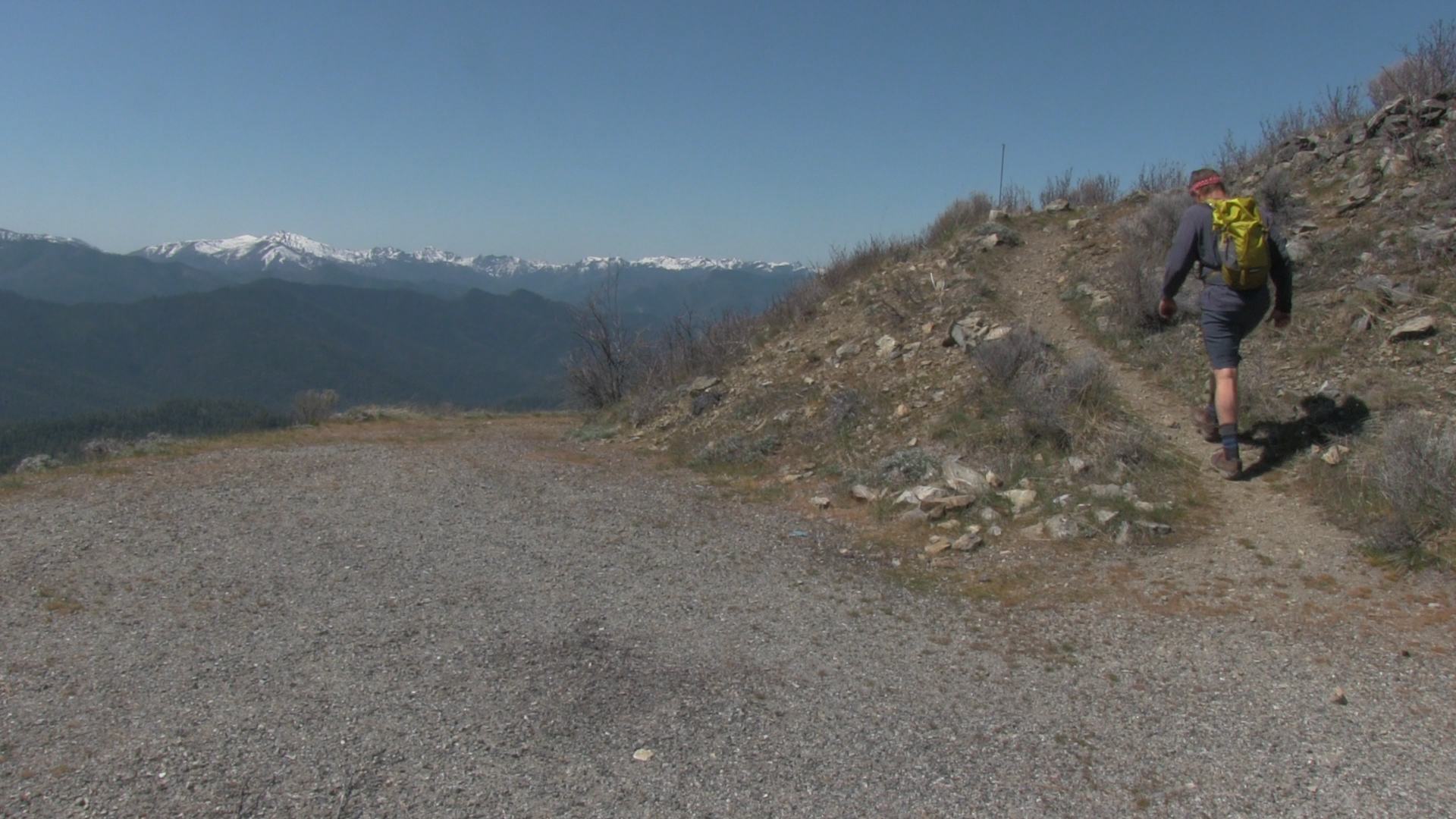
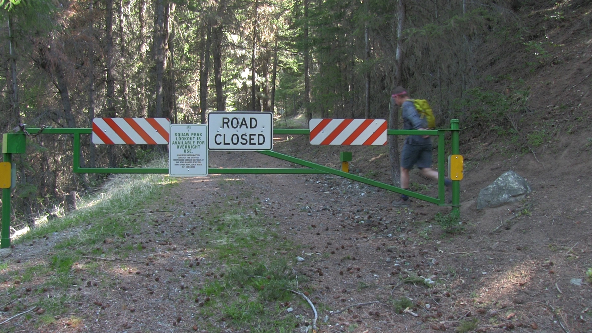
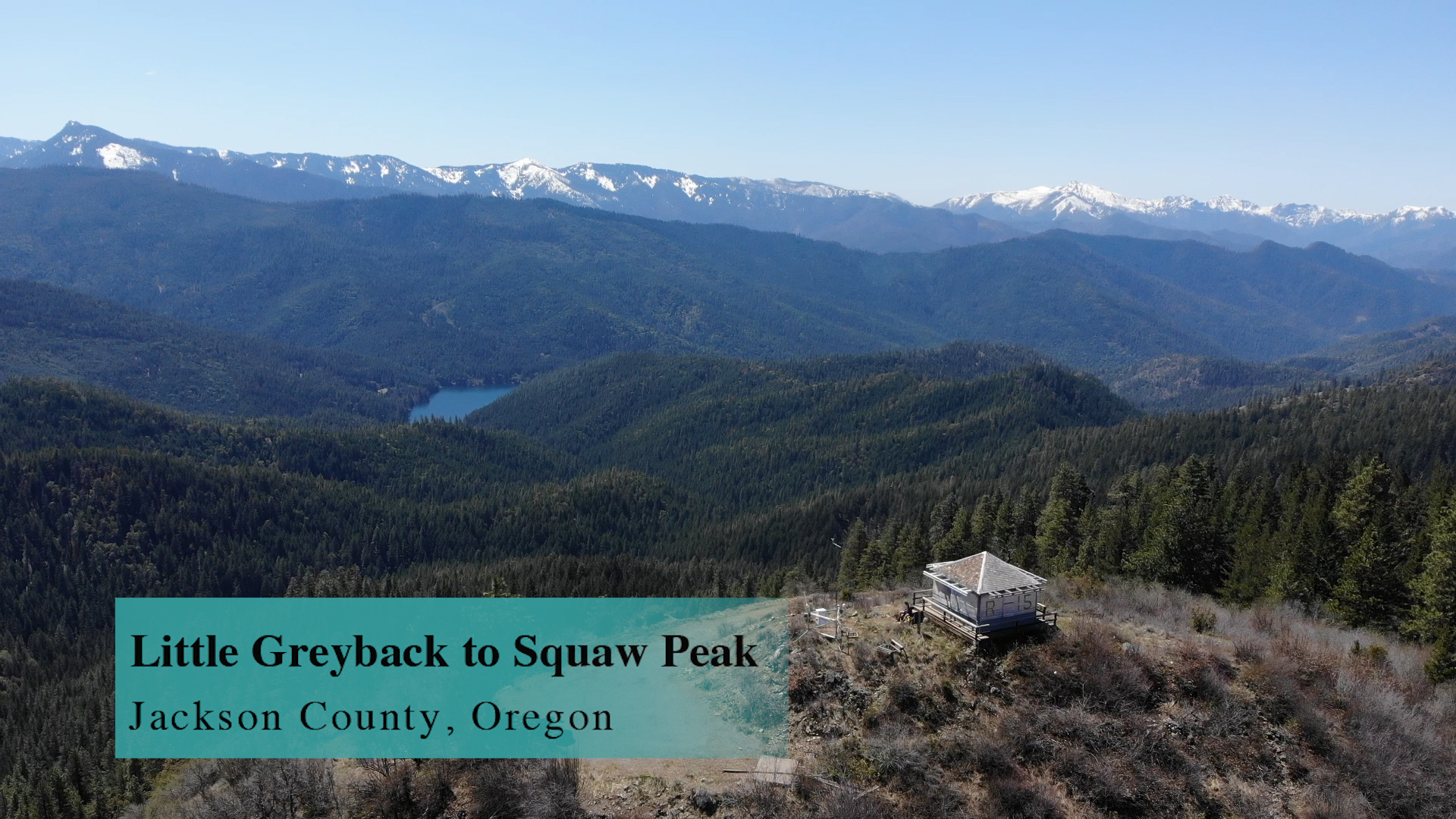
When the Little Greyback Trail ends after 4.2 miles at the Forest Service road you will turn right and head downhill. I does feel wrong because we are going to the top of a peak after all. But the Forest Service road heads down for only 1/4 mile and then hits a big Forest Service road intersection. Look straight ahead and you will see a white pipe gate with lots of signs talking about how you can go online and rent the Squaw Peak lookout. Well let’s just hike up there instead, shall we? It’s. A. Hike! After 4 1/2 miles this last mile-ish is steep. But when you emerge at the top it will be totally worth it. Have lunch. Text a selfie. (I had cell service up there!) Enjoy the amazing 360 views. A super satisfying destination hike. And now… enjoy the downhill. You earned it.